Case Studies
Strengthening forecast-signals in agriculture through the development of innovative services in the framework of regional economic development

The purpose of this study was to identify, select and analyze international experiences for farmmodels and to establish an operational monitoring center, forecast-signaling systemsand predictability model.e plant diseases and pests, farm production, diseases and natural damages(frosts, floods, etc.) using a set of criteria and tools within the project “Strengthening forecast-signalsin agriculture through the development of innovative services in the context of economicdevelopment regional.
This study presents the micro-simulation model of the farm that uses data collected on the farmthrough questionnaires. Farm production and financial data from on-farmquestionnairesare combined with area-specific climate data, including various measurements of rainfall, temperatureand soil moisture. The model is evaluated as a statistical model that links farmresults (e.g., arable crops, livestock products, vegetables, fruits, etc.), with the use of inputs (eg fuel, chemical fertilizers, labor, etc.) and changes in farm stock (e.g. change in live stock) with fixed farminputs, input and product prices, climate variables and other control variables.
The study also outlines descriptions of similar international practices / policies for agricultural fieldmeasurement and monitoring systems, pest disease issues in agriculture and livestock, legal and institutional framework for agricultural information systems, disease predictability models and software respectively, the impact of agriculture from meteorological events and the need to set upa modern forecasting system.
Forest Fires in Albania
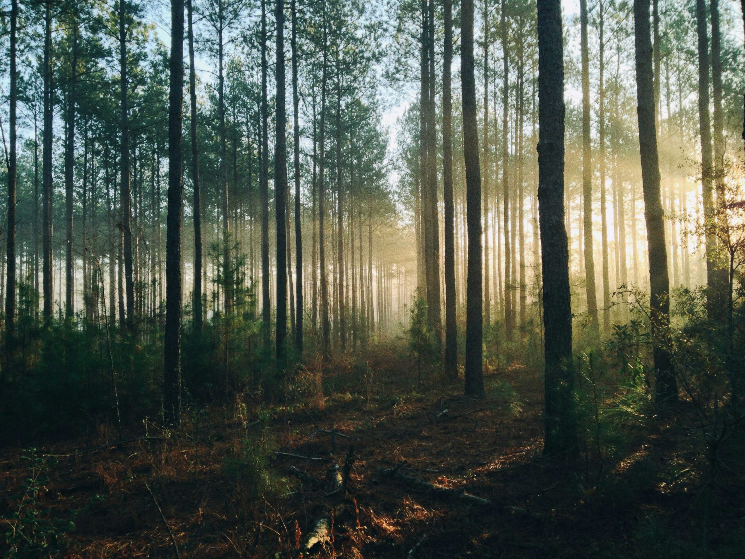
The objective of this study is to provide a general view of the forest fires in Albania, their impacts on forest ecosystem services, and gaps in the existing legal framework. The last year, media coverage of catastrophic forest fires in Vlora (National Park of Llogara), Gjirokaster, Kukes (Rrune mountain), Mirdite (Thirre site), Voskopje, Fier and Kruje among others, has captured widespread attention. Causes and consequences underlying these disasters differ vastly from a location to another. Fires have destroyed land, forests and houses and caused the death of one person in Gjirokastra and one military officer was injured and hospitalized.
Forest disturbances can be abiotic (e.g., droughts), biological (e.g., bark beetle), and human-made (e.g., deforestation). Fire is particular case, at the crossroad of natural and human influences, whose potential for disaster is a source of growing concern all over the world.
Forests provide a wide range of ecosystem services. In addition to providing food, fuel and fibre, forests clean the air, filter water supplies, control floods and erosion, sustain biodiversity and genetic resources, and provide opportunities for recreation, education, and cultural enrichment. Forest fires, in fact, alter water quality and carbon cycling, and can lead to changes in vegetation types and structures, at least temporarily and particularly in non-fire prone ecosystems which are more susceptible to impacts (Vaz et al., 2017; Harper et al., 2018). In addition, the wildfires, play key roles in ecosystem dynamics and the retention of species that have evolved in response to fire (Pausas and Keeley 2009).
Space for Hydro Energy Sector Snow Water Equivalent and snow

Hydroelectricity uses water from rivers or stored in dams to produce electricity through the rotation of turbine blades. To manage hydroelectric plants and plan the production or storage of water and evaluate their impacts on the power market, it is necessary to know not only the rain, but also the water contained within the snowpack (snow water equivalent).
In situ measurements combined with satellite and meteorological model could improve the estimation of the snow cover and of snow water equivalent and reduce exposure to their natural variability. A proper estimation of water content in the snow could let energy producers to better manage the natural resources and make more efficient the renewable power production.
Technical feasibility of the proposed services, and establish a mock-up / prototype
The environmental benefits of the proposed services
Define business plan and models for service operations
Define a roadmap for services implementation and demonstration
Support from users and potential customers for potential follow-on and commercial stage.
Objectives:
❖ A tool to produce an estimation of the snow water equivalent and snow cover
❖ A combination of satellite data, weather forecast modelling and in situ data
❖ Geographic coverage and pilot areas selected
Cultural heritage at risk evacuation of cultural collection plan
Protecting cultural heritage during an armed conflict is difficult and sometimes life-threatening. However, communities trapped in war zones boldly seek to save their cultural heritage, as it provides a sense of continuity between unrest and insecurity. This study is the result of knowledge gained from field experience gathered through the ICCROM Initiative Capacity Building for Cultural Heritage First Aid in Times of Crisis. This study helps step by step to evacuate collections in extreme conditions. It aims to help those communities and institutions that seek to prevent the destruction and looting of cultural property during emergency situations. It can also be used to train staff and improve emergency preparedness in cultural venues. Given that there are no two similar emergencies, below this study will outline a study and innovative proposals that can be personalized to meet needs in a specific emergency context.